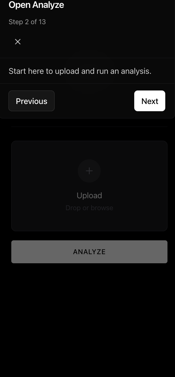
Oceanir
BLOG
PRICING
⌘K
↑↓Navigate↵SelectescClose
[ 7 suggestions ]
BLOGSOLUTIONSPRICINGUSE CASESGET STARTED
Solutions/Law Enforcement
[ 01 ]

Upload a photo.
We tell you where it was taken.

Industry Solution

Law Enforcement

Turn image evidence into field leads quickly.

Oceanir pairs Stingray alerts with geo-estimation so investigators can move from a plate hit or photo to ranked location leads in minutes.

[Explore workflow]

Phase 1

01:   The Numbers
Oceanir pairs Stingray alerts with geo-estimation so investigators can move from a plate hit or photo to ranked location leads in minutes.
<10sInvestigation Turnaround
Street-LevelTypical Precision
Stingray + GeoOutput Style
Law Enforcement
01:Analysis
02:Workflow
03:Evidence

Phase 2

02:   How It Works
01Add wanted or stolen plates to Stingray hotlists.
02Review live detections with camera location, timestamp, and capture frame.
03Run geo-estimation on case images when GPS data is missing.
04Prioritize field follow-up from ranked leads instead of broad sweeps.
Try It Now
Workflow

Phase 3

03:   Use Cases
Live Plate Detection for Active Cases
Get immediate alerts when a hotlisted vehicle appears on a connected camera network.
Missing Persons and Fugitive Leads
Use plate history and image geo-estimation together to narrow the search area quickly.
Evidence Photo Verification
Check whether submitted photos actually match the claimed location before resources are dispatched.
Cross-Agency Coordination
Share clean, timestamped detection and location packets with partner agencies for faster handoff.
DetectivesDigital forensics teamsFusion centersMissing-person units
Use cases

Law Enforcement Intelligence — The Data

Most evidence photos arrive without location data. Oceanir fills the gap.

OSINT Usage by Investigation Type

Human trafficking92%
Narcotics / cartel87%
Terrorism & extremism84%
Financial crime71%
Missing persons68%

Source: 3GIMBALS, DOJ AI & Criminal Justice Report 2024

Evidence Processing

85%
OSINT-based intel
of law enforcement cases
73%
Images lack GPS
after social media strip
40%
Faster case closure
with geo-estimation tools

Sources: Falkor.ai, Amped Software, arxiv.org

Oceanir Impact

<10sLocation estimate per image
StreetTypical precision level
0GPS or metadata required
RankedCandidates with confidence

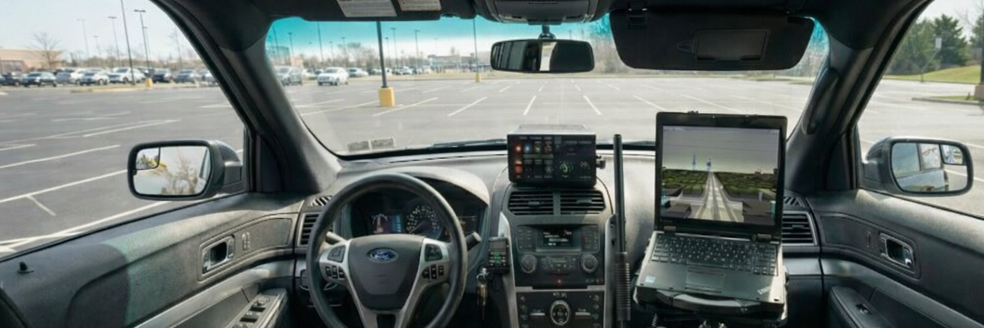
Stingray in the Field

Built for real case pressure: live plate alerts, fast verification, and cleaner handoffs.

01Hotlist Alerts
Stingray flags hotlist plates while the car is still in view.

Stingray flags hotlist plates while the car is still in view.

When a wanted or stolen plate passes a connected camera, the alert includes camera location, timestamp, and a frame capture. Teams can act on a live lead instead of reviewing footage hours later.

Wanted and stolen vehicle hotlistsInstant camera alert feedPer-camera confidence reviewShift-level notification routing
02Case Buildout
Turn scattered sightings into a usable movement timeline.

Turn scattered sightings into a usable movement timeline.

Investigators can search a plate across the full detection history and see where it appeared, in order. Combined with geo-estimation from evidence photos, teams get cleaner timelines and fewer dead-end leads.

Historical plate searchCross-jurisdiction handoff packetsGeo-estimation + ALPR correlationExport-ready evidence logs

Stingray Snapshot

<30sTypical alert latency
24/7Network monitoring
FullPlate history search
<10sGeo-estimation assist

Stingray for daily investigations

Use Stingray for live plate alerts and history, then use geo-estimation for images that arrive with no location data.

Start a project
Value Upfront
Results Follow

Why Oceanir

Oceanir does not replace investigator judgment. It shortens the path from raw evidence to a defensible next step.

Request A Pilot

Run Oceanir on your case evidence

We set up a 30-day proof-of-concept against your evidence photos. No integration required — just image files and case references. You get a geo-estimation intelligence report with ranked location candidates for every submission.

01Send us a batch of evidence images
02Oceanir estimates probable locations with confidence
03Receive a geo-estimation intelligence report per image

FAQ

All Solutions

No. Stingray and geo-estimation are assistive tools. Investigators stay in control of decisions and case strategy.

For image analysis, teams typically get street-level ranked candidates with confidence context. For plate work, Stingray returns live and historical detections tied to camera locations.

Yes. Geo-estimation is designed for image-only analysis and does not require GPS metadata.

No. The workflow is built around place verification and vehicle detection, not identity matching.

Oceanir

Have a pilot or live case in mind?

Talk to us

Company

  • Pricing
  • Contact Sales

Resources

  • Documentation
  • Blog
  • Coverage

Social

  • X (Twitter)
  • GitHub
  • Discord

Public Sector

  • Law Enforcement
  • Corrections
  • Education & Campus
  • Transportation
  • Emergency Response

Business

  • Retail & Grocery
  • Healthcare
  • Logistics
  • Corporate Security
  • Manufacturing

Media & Legal

  • Journalism
  • Legal Teams
  • Insurance
  • All solutions

By Use Case

  • 01
    Crime Scene AnalysisGeo + Property workflow
  • 02
    Vehicle RecoveryStingray + Geo workflow
  • 03
    Claim VerificationGeo + Property workflow
  • 04
    Missing PersonsGeo-estimation workflow
  • 05
    Organized Retail CrimeStingray + Geo workflow
  • 06
    Media AuthenticationGeo-estimation workflow

© 2026 Oceanir. All rights reserved.

Terms of ServicePrivacy PolicyCookie Policy